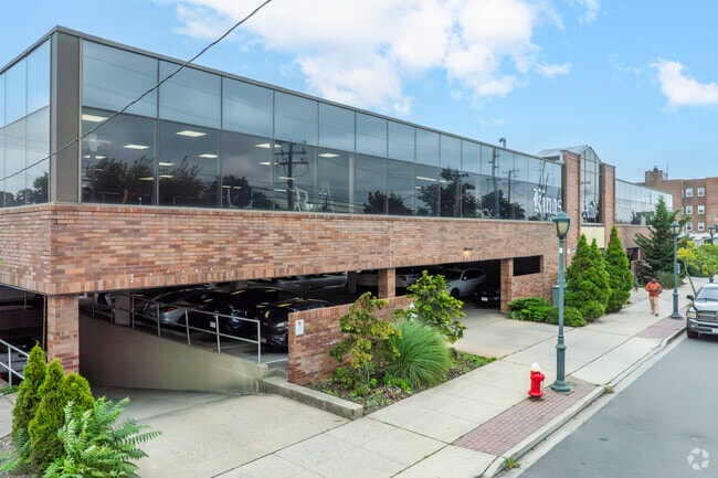
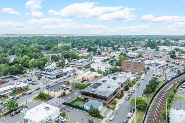
Property Record
1255 Hewlett Plz, Hewlett, NY 11557
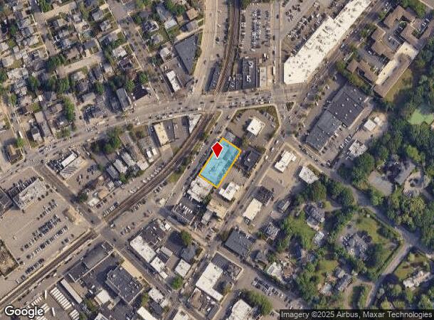
NEARBY LISTINGS FOR SALE OR LEASE
Property Detail
1255 Hewlett Plz
2089-39-207-00-0469-0
TOWN #1 SCH DIST 014
Gymhealthspa
Nassau
X
New York
36059C0214H
469
2025
0.39 AC
2025
Southern Nassau
411700
Long Island (New York)
46,374 SF
Nassau County-Suffolk County, NY
DEMOGRAPHICS near 1255 Hewlett Plz
1 Mile
3 Mile
5 Mile
2024 Total Population
23,848
175,040
542,099
2029 Population
23,602
169,319
519,089
Pop Growth 2024-2029
(1.03%)
(3.27%)
(4.24%)
Average Age
39
40
41
2024 Total Households
7,302
55,575
178,823
HH Growth 2024-2029
(1.15%)
(3.42%)
(4.30%)
Median Household Inc
$150,787
$116,689
$104,193
Avg Household Size
3.20
3.00
2.90
2024 Avg HH Vehicles
2.00
2.00
2.00
Median Home Value
$737,028
$673,378
$650,633
Median Year Built
1954
1953
1954
Nearby Places
Map Layers
Map Styles
 Street
 Aerial
- Restaurants
- Banks
- Shops
- Fitness
- Groceries
PUBLIC TRANSPORTATION
TRANSIT/SUBWAY
Hewlett Station (Far Rockaway Branch - Long Island Rail Road)
DRIVE
WALK
Distance
Hewlett Station (Far Rockaway Branch - Long Island Rail Road)
1 min
3 min
0.2 mi
Gibson Station (Far Rockaway Branch - Long Island Rail Road)
DRIVE
WALK
Distance
Gibson Station (Far Rockaway Branch - Long Island Rail Road)
3 min
16 min
0.8 mi
Woodmere Station (Far Rockaway Branch - Long Island Rail Road)
DRIVE
WALK
Distance
Woodmere Station (Far Rockaway Branch - Long Island Rail Road)
3 min
18 min
0.9 mi
COMMUTER RAIL
Hewlett Station (Far Rockaway Branch - Long Island Rail Road)
DRIVE
WALK
Distance
Hewlett Station (Far Rockaway Branch - Long Island Rail Road)
1 min
3 min
0.2 mi
Gibson Station (Far Rockaway Branch - Long Island Rail Road)
DRIVE
WALK
Distance
Gibson Station (Far Rockaway Branch - Long Island Rail Road)
3 min
16 min
0.8 mi
AIRPORT
John F Kennedy International
DRIVE
WALK
Distance
John F Kennedy International
16 min
8.5 mi
LaGuardia
DRIVE
WALK
Distance
LaGuardia
26 min
15.5 mi
Newark Liberty International
DRIVE
WALK
Distance
Newark Liberty International
53 min
35.3 mi
Freight Ports
NY - Red Hook Container Terminal
DRIVE
WALK
Distance
NY - Red Hook Container Terminal
37 min
20.0 mi
Nearby Properties
Address
Land Use
TOTAL SIZE
Lot Size
Zoning
Address
Land Use
TOTAL SIZE
Lot Size
Zoning
182.50 AC
M1-1
Address
Land Use
TOTAL SIZE
Lot Size
Zoning
124.60 AC
M1-1
Address
Land Use
TOTAL SIZE
Lot Size
Zoning
27.23 AC
PARK
Address
Land Use
TOTAL SIZE
Lot Size
Zoning
64,618 SF
8.04 AC
Address
Land Use
TOTAL SIZE
Lot Size
Zoning
93.35 AC
PARK
Address
Land Use
TOTAL SIZE
Lot Size
Zoning
178,870 SF
7.60 AC
M1-1
Address
Land Use
TOTAL SIZE
Lot Size
Zoning
5,296 SF
37.42 AC
PARK
Address
Land Use
TOTAL SIZE
Lot Size
Zoning
213,338 SF
2.91 AC
R3X
Address
Land Use
TOTAL SIZE
Lot Size
Zoning
97,190 SF
1.75 AC
R3X
Address
Land Use
TOTAL SIZE
Lot Size
Zoning
260,000 SF
4.14 AC
R2
Address
Land Use
TOTAL SIZE
Lot Size
Zoning
141,782 SF
7.39 AC
M1-1
Address
Land Use
TOTAL SIZE
Lot Size
Zoning
85,330 SF
2.91 AC
R3-2
Address
Land Use
TOTAL SIZE
Lot Size
Zoning
4,000 SF
23.88 AC
PARK
Address
Land Use
TOTAL SIZE
Lot Size
Zoning
59,963 SF
1.55 AC
M1-1
Address
Land Use
TOTAL SIZE
Lot Size
Zoning
73,300 SF
1.93 AC
R2
Address
Land Use
TOTAL SIZE
Lot Size
Zoning
55,392 SF
1.71 AC
R3-1
Address
Land Use
TOTAL SIZE
Lot Size
Zoning
2,634,357 SF
57.63 AC
Address
Land Use
TOTAL SIZE
Lot Size
Zoning
28.12 AC
R3-2
Address
Land Use
TOTAL SIZE
Lot Size
Zoning
10,405 SF
4.97 AC
R3-1
Address
Land Use
TOTAL SIZE
Lot Size
Zoning
13,334 SF
2.11 AC
R2
Address
Land Use
TOTAL SIZE
Lot Size
Zoning
33,912 SF
2.37 AC
R3X
Address
Land Use
TOTAL SIZE
Lot Size
Zoning
3.48 AC
R3-2
Address
Land Use
TOTAL SIZE
Lot Size
Zoning
31,157 SF
0.92 AC
R3X
Address
Land Use
TOTAL SIZE
Lot Size
Zoning
10,000 SF
0.46 AC
R3-2
Address
Land Use
TOTAL SIZE
Lot Size
Zoning
14,966 SF
0.89 AC
R2
Address
Land Use
TOTAL SIZE
Lot Size
Zoning
8,000 SF
0.51 AC
R3X
Address
Land Use
TOTAL SIZE
Lot Size
Zoning
5,252 SF
0.71 AC
M1-1
Address
Land Use
TOTAL SIZE
Lot Size
Zoning
9,360 SF
0.55 AC
R3X
Address
Land Use
TOTAL SIZE
Lot Size
Zoning
88.30 AC
Address
Land Use
TOTAL SIZE
Lot Size
Zoning
350.74 AC
The World's #1 Commercial Real Estate Marketplace
Connect with us
© 2025 CoStar Group
The information above has been obtained from sources believed reliable. While we do not doubt its accuracy we have not verified it and make no guarantee, warranty or representation about it. It is your responsibility to independently confirm its accuracy and completeness. Any projections, opinions, assumptions, or estimates used are for example only and do not represent the current or future performance of the property. The value of this transaction to you depends on tax and other factors which should be evaluated by your tax, financial, and legal advisors. You and your advisors should conduct a careful, independent investigation of the property to determine to your satisfaction the suitability of the property for your needs.